 |
|||||||||||||||
 |
||
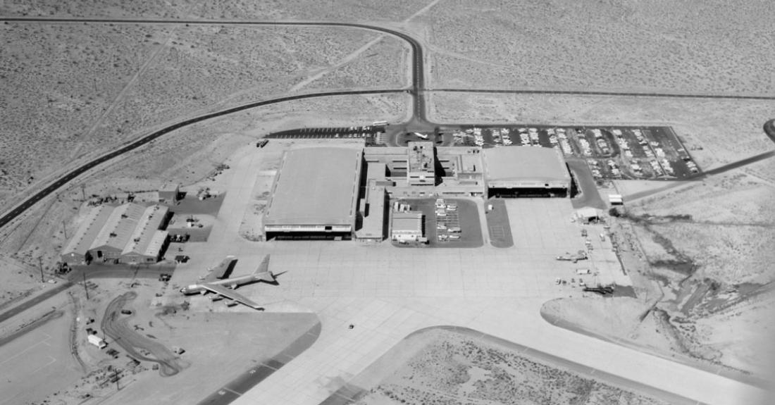
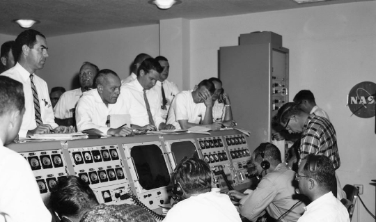
The NASA ramp at the Flight Research Center during the time of the X-15. All flights originated here at the NASA facility at Edwards AFB. The primary control room was located here, as was the main tracking station, used for the early parts of the mission after B-52 take-off, then for the termination of each of the 188 X-15 missions that returned home. TD Barnes collection |
||
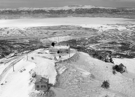
— Beatty, Nevada, High Range Tracking Station — |
||
 |
||
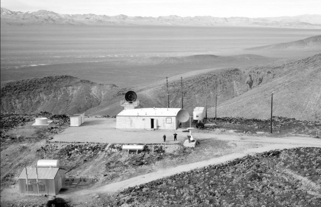
The High Range station outside Beatty, Nevada. The site is approximately 15 miles north of town off of US Route 95, and overlooks the Sarcobatus Flat. TD Barnes collection |
||
 |
 |
|||
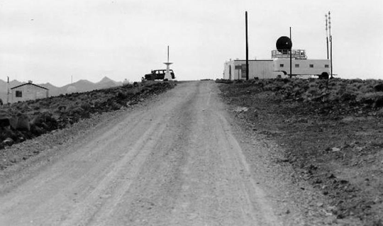
Coming south on the road that hugged the ridge top to the station. TD Barnes collection |
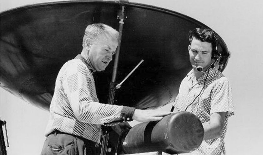
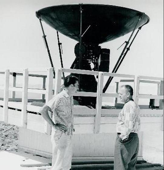
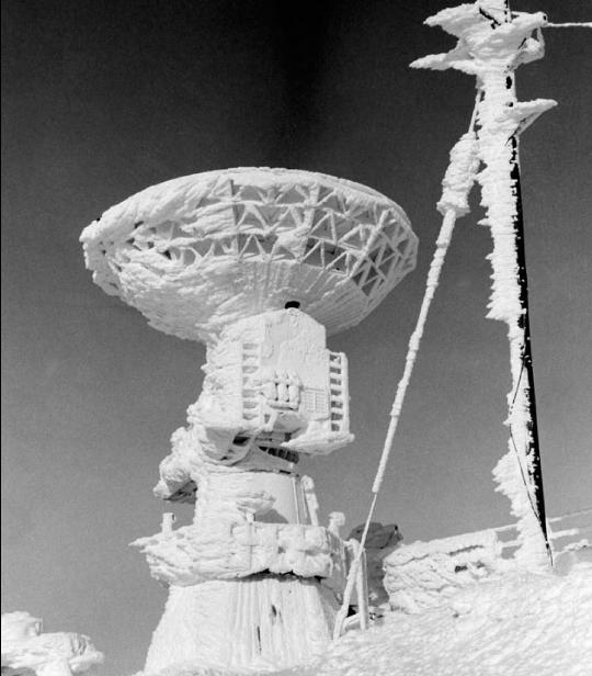
Checking out one of the radar dishes and electronics. TD Barnes collection |
|||
 |
 |
|||
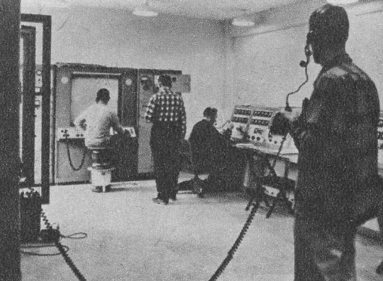
Radar control equipment at the Beatty High Range site. TD Barnes collection |
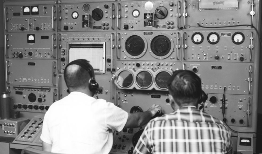
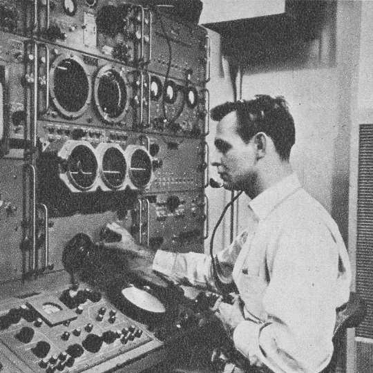
Inside the control room during flight. TD Barnes collection |
|||
 |
 |
|||
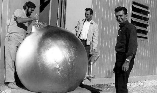
Preparing to send up a weather balloon before an X-15 flight. TD Barnes collection |
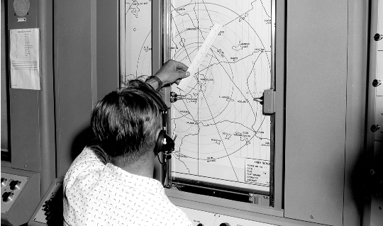
X-15 flight plotting board at the Beatty High Range site. TD Barnes collection |
|||
 |
 |
|||
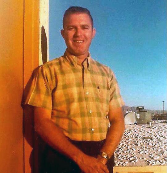
TD Barnes was the Beatty site manager. TD Barnes collection |
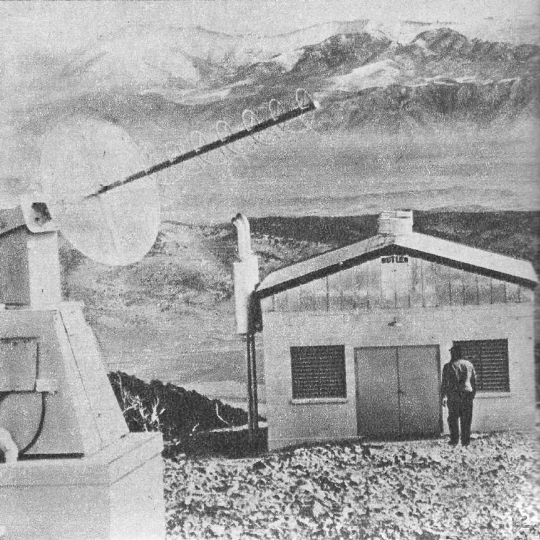
Engineers next to one of the site's antennae. TD Barnes collection |
|||
 |
 |
|||
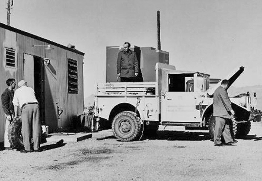
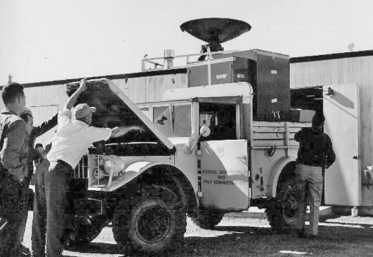
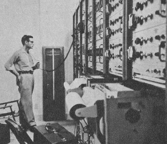
A NASA transport truck brings up some new equipment to be off-loaded into the control room, but the truck appears to have developed problems of its own. TD Barnes collection |
||
— Ely, Nevada, High Range Tracking Station — |
||
 |
 |
|||
The High Range station outside Ely, Nevada. The road to the site is approximately 11 miles west of town off of US Route 50. author's collection |
||||
Inside the Ely High Range station. author's collection |
||||
 |
 |
|||
An engineer heads to the out building. author's collection |
||||
 |
||||
Aftermath of an ice storm at the Ely station. Note the high winds blew sideways! TD Barnes collection |
||||
 |
||||
Images of the engineers with the electronic equipment used to track X-15 flights located inside the Ely station. author's collection |
||
 |
||
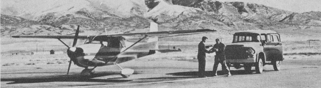
The raw data from the radar and telemtetry was often loaded onto a small plane and flown back to the Flight Research Center at Edwards for processing and analysis. The airport is Yelland Field, outside Ely, Nevada. author's collection |
||
— X-15 Mission Profile Graphics — |
||
 |
||
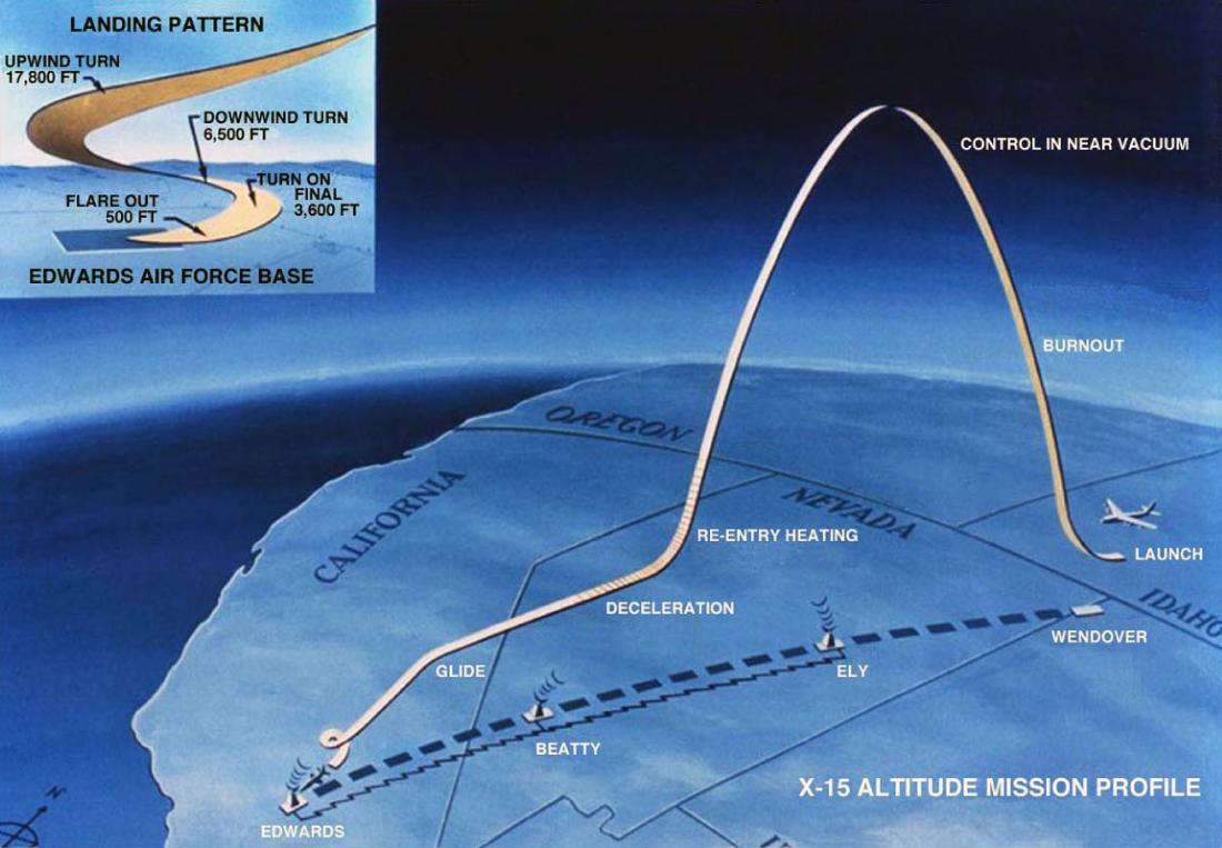
Probably the most seen and used version of the mission profile graphic, but it only highlights the altitude flights, while ignoring the lower-altitude speed flights. Armstrong Flight Research Center |
||
 |
||
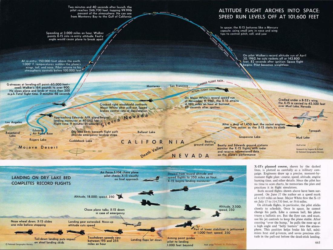
With their informative and excellent graphics, National Geographic takes on the job of explaining the mission profiles for various types of X-15 research flights in a 1962 article. National Geographic |
||
 |
 |
|||
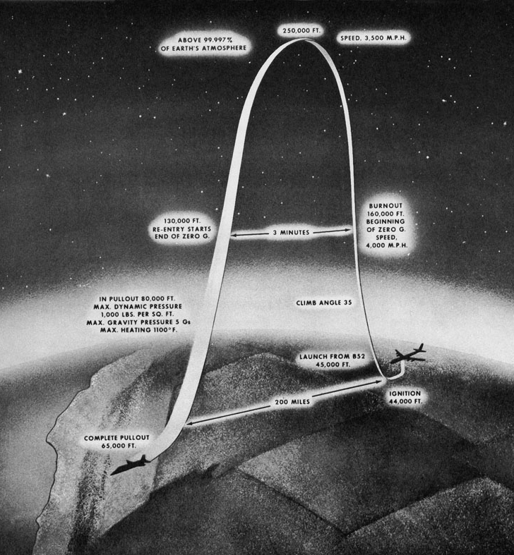
Early version of the high-altitude flight profile. NASA Headquarters |
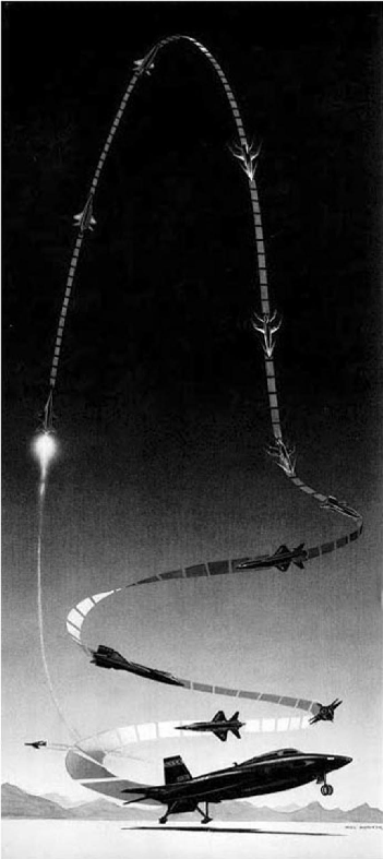
A version of the flight profile graphic from Life magazine. Life Magazine |
|||
 |
||
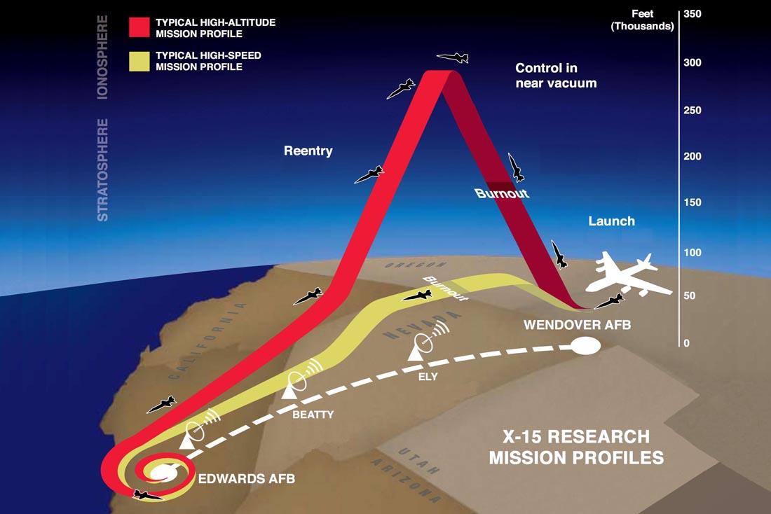
A modern impression of X-15 flights along the High Range. The yellow band signifies lower altitude speed runs, and the red band the high-altitude sub-orbital flights. author's collection and modified by author |
||
— Dry Lakes used for X-15 landings — |
||
 |
The High Range consisted of a 400-mile long corridor stretching from Edwards AFB in the southwest, to the Bonneville Salt Flats in the northeast. There were two radar sites: Beatty and Ely, Nevada (see above). A series of dry lakebeds dotted this range, and they served as locations for both routine landings at Rogers to emergency landings at six other lakebeds during the run of the X-15 program. Note all lakbed photos are oriented with North being to the top of the page.
X-15 routine landings at Rogers Dry Lake: 187
In-Flight Emergencies: |
||||||||||||||||||||||||
Flight 004 047 051 074 108 157 159 171 173 178 184 191 |
Date 5 Nov. 59 10 Jan. 62 20 Apr. 62 9 Nov. 62 21 May 64 6 May 66 1 Jul. 66 8 Sep. 66 6 Oct. 66 26 Aor. 67 29 Jun. 67 15 Nov. 67 |
Pilot Crossfield Petersen Armstrong McKay Thompson McKay Rushworth McKay Adams Dana Knight Adams |
Org. NAA USN NASA NASA NASA NASA USAF NASA USAF NASA USAF USAF |
Location Rosamond Mud Rogers Mud Cuddeback Delamar Mud Smith Ranch Cuddeback Silver Mud Randsburg |
Remarks Engine fire and explosion Engine failed to start G-limit atmospheric bounce Engine would not exceed 30% thrust Engine shutdown at 41 seconds Engine shutdown at 35 seconds No external tank fuel flow indication Low fuel line pressure Fuel tank bulkhead ruptured Low fuel line pressure Electric system failure Fatal crash |
||||||||||||||||||||
 |
|||||||||||||||||||||||||
 |
 |
||||||||||||||||||||||||
 |
|||||||||||||||||||||||||
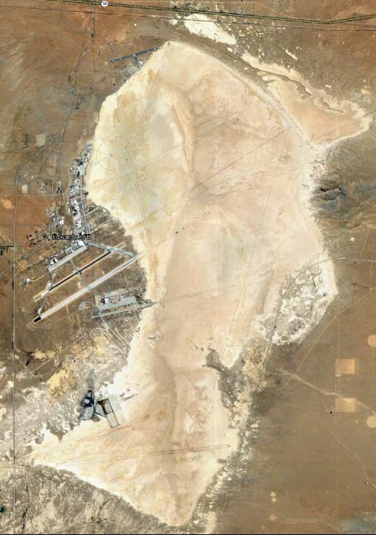
Rogers Dry Lake. Edwards AFB resides on the left margin of the ancient lakebed. The primary lakebed was used 187 times for routine landings, and once for an in-flight emergency, where Neil Armstrong barely made it back to the extreme south end of the Rogers lakebed after his atmospheric bounce took him 45 miles south of Edwards. Google Earth |
|||||||||||||||||||||||||
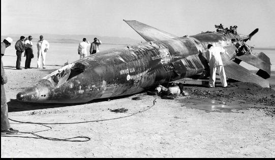
X-15 no. 2 following an emergency landing by Jack McKay at Mud on 9 Nov. 1962. Armstrong Flight Research Center |
|||||||||||||||||||||||||
 |
 |
|||
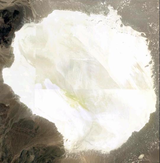
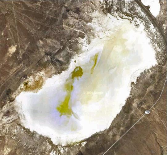
Mud Dry Lake. Nearest town is Tonopah, Nevada. Mud was used more than any other lakebed for X-15 emergencies with 4 landings. Google Earth |
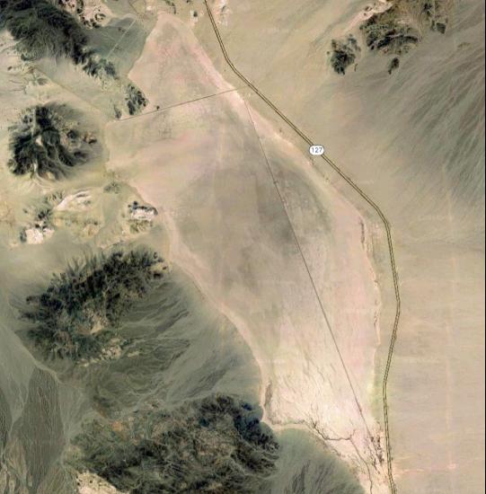
Silver Dry Lake. Nearest town is Baker, California. There was 1 emergency landing here. Google Earth |
|||
 |
||||
 |
||||
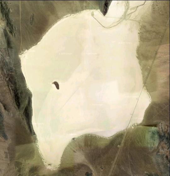
Rosamond Dry Lake. Nearest town is Rosamond, California. The road at top leads east to Edwards AFB. There was 1 emergency landing here. Google Earth |
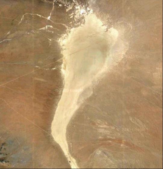
Smith Ranch Dry Lake. The nearest town is Austin, Nevada. This is the lakebed farthest north used during the program. There was 1 emergency landing here. Google Earth |
|||
 |
||||
 |
||||
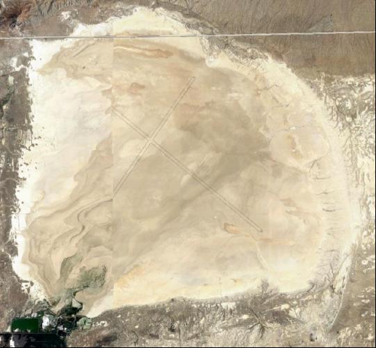
Cuddeback Dry Lake. The closest town is Boron, California. This lakebed is the nearest one to Rogers Dry Lake. There were 2 emergency landings here. Google Earth |
Delamar Dry Lake. The nearest town is Alamo, Nevada. There was 1 emergency landing here. Google Earth |
|||